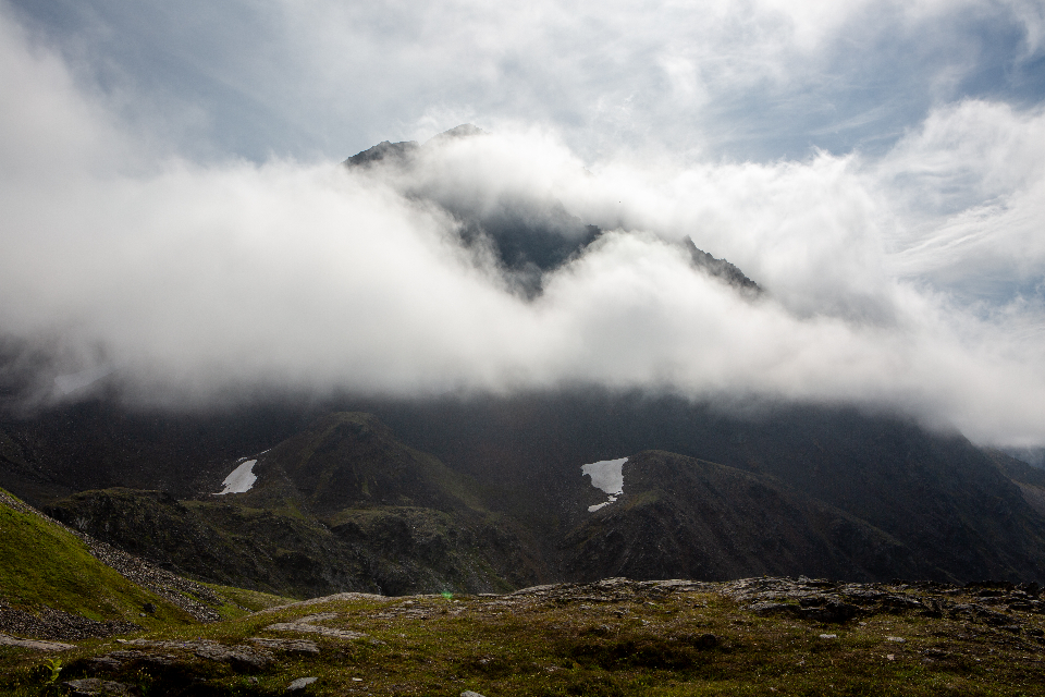
Mountain Weather Does Not Behave Like Valley Weather
The forecast you checked before leaving home was made for a town, at a particular elevation, on flat ground. The cove sits in different air. Cloud forms where none was predicted, rain falls on one slope and not the other, and a still morning becomes a windy afternoon with no warning from the app.
Learning to read what is actually happening around you is the single most useful skill for anyone spending time in the mountains, and it takes far less expertise than people assume.
Temperature and Elevation
Air cools as it rises, at a rate of roughly two degrees Celsius for every three hundred metres of elevation gain. That figure is worth remembering, because it means a pleasant morning at the cabin can be genuinely cold at the top of a nearby ridge.
- A thousand-metre climb costs you six or seven degrees before wind is considered.
- Wind chill compounds it, and exposed ridges are almost always windier than the sheltered ground below.
- Valleys trap cold air overnight, which is why the coldest place at dawn is often the lowest point rather than the highest.
The practical rule: carry an extra layer for anything that gains significant elevation, even when the day starts warm.
Reading the Sky
Cloud shape carries a surprising amount of information, and a handful of types cover most of what matters.
What to Watch For
- High wispy cloud spreading from one direction often precedes a front by a day or so. It is the earliest visible warning you get.
- Small fair-weather clouds growing tall through the morning signal building instability and a real chance of afternoon storms.
- A cap of cloud settling on the summits means rising humidity and usually rain within hours.
- A ring around the moon is ice crystals high in the atmosphere, which frequently means weather within a day or two.
Afternoon Storms Are Predictable
In warmer months, mountains generate their own weather. The ground heats, air rises, moisture condenses, and by early afternoon a clear morning can produce a serious thunderstorm.
This is why experienced walkers start early and plan to be off high ground by early afternoon. It is not caution for its own sake; it is a response to a pattern that repeats with some reliability through the season.
- Be off exposed ridges by early afternoon in unsettled conditions.
- Count between flash and thunder — roughly three seconds per kilometre — and move down if the gap is closing.
- Avoid isolated trees, summits and open water during electrical activity.
- Have a turnaround time decided before you set off, and honour it regardless of how close the top feels.
Wind and What It Tells You
A shift in wind direction is often the first sign of change, ahead of any visible cloud. Wind that swings and strengthens usually means a front is arriving. Wind that drops entirely and leaves a heavy stillness in warm weather can precede a storm.
The cove has its own local pattern too. Air drains downhill overnight and flows back up through the day, which is why mornings are often still and afternoons breezy regardless of the wider forecast.
Using Forecasts Sensibly
Forecasts are useful, provided you understand what they are describing.
- Use a mountain-specific forecast where one exists; it will give freezing level and summit wind, which are the numbers that matter.
- Check the elevation a forecast applies to before trusting its temperature.
- Read the trend across several days, not one day in isolation.
- Treat the forecast as a starting point and what you see out of the window as the correction.
The Habit Worth Building
Step outside for two minutes before deciding anything. Note the wind direction, whether cloud is building or dissolving, whether the summits are clear, and whether the air feels heavy or dry.
Do that every morning for a week and you will begin to notice patterns that no forecast will tell you. It is also, quite separately, a good way to start a day at the cabin.
Seasonal Patterns Around the Cove
Each season brings its own characteristic weather, and knowing the pattern is more useful than any single forecast.
- Spring is the most volatile. Warm days alternate with cold snaps, storms move through quickly, and late frosts are common well after the first warm week has convinced everyone winter is over.
- Summer settles into a rhythm of humid mornings, building cloud and afternoon thunderstorms, with the heaviest activity in the middle of the season.
- Autumn is the most reliable stretch of the year — cool, dry, stable air, and the clearest long-distance visibility of any season.
- Winter brings the widest swings. Ice is a bigger practical concern than snow, and the difference between rain and freezing rain is often a matter of a hundred metres of elevation.
Fog, Which Is Its Own Category
Valley fog forms overnight when cold air drains downhill and moisture condenses. It sits in the low ground and usually burns off within a few hours of sunrise, which means a morning that looks impossible from the cabin window can be entirely clear from the ridge above.
This catches visitors out constantly. If the cove is under fog and the sky above it is bright, walking uphill is frequently the fastest route to a view. Upslope fog, formed when moist air is pushed up a mountainside, behaves in the opposite way and tends to persist.
Neither is dangerous in itself, but both reduce visibility on trails and roads more than expected. Carry a light, tell someone your route, and allow considerably more time than the distance suggests.
Read next: Best Time to Visit the Smoky Mountains: A Season-by-Season Guide